Home » Posts tagged 'photo essay'
Tag Archives: photo essay

Travel 2017: More Images of Versailles
Here are some additional photographs from our day in Versailles:

The statue of Louis XIV outside of Versailles.

Outside the gates of Versailles.

Louis XIV emblem ‘the Sun God’ on the gates of Versailles.

Inside the chapel of Versailles.

Walking through one of the corridors of Versailles.

Versailles exhibits magnificent architecture.

I loved this detailed window latch, looking out at the gardens of Versailles.

Beautiful detailed moldings in the Palace of Versailles.

Absolute elegance.

The finest museum-quality decor in every room.

The Louis XIV Bed Chamber.

Finest design.

The entrance to the Hall of Mirrors.

Spectacular finishings in the Hall of Mirrors.

Busts of War Heroes in the Battles Gallery.

Ceilings in the Battles Gallery of Versailles.

The Orangerie welcomes guests of the Palace to the gardens of Versailles.

Statues are found at every turn as you wallk through the gardens of Versailles.

Approaching the Grand Trianon.
Travel Date: May 19, 2017 (Day 7)
Thanksgiving at Circle B

An Alligator in the marsh at Circle B Bar Reserve.
Michael and I headed to Florida over Thanksgiving week to spend time with both our families. We celebrated Michael’s side of the family in Inverness on Thursday and then with my family in Auburndale on Saturday. Sunday morning, we decided to spend a few hours at the Circle B Bar Reserve on Lake Hancock.
Named after the cattle ranch that once existed on the property, Circle B was restored to its natural state by Polk County, beginning in 2005. The restoration that has occurred on this marshland in just ten years is pretty impressive.
The visit brought back many memories and images of the Florida that I grew up in back in the 1970’s.
Here are a few images I shot during our visit:


My family at Circle B Bar Reserve. Photographed by my Father.
I’d return here to Circle B over Disney any day.

The Haunting Faces of Angkor Thom: A Photo Essay

A Sweaty Selfie at Angkor Thom.
Angkor Thom was probably my favorite location of all that we visited in Southeast Asia. There’s an aura that is simply magical. I found myself standing– high up amongst the faces in the ruins– and I got kind of emotional. How incredibly lucky was I to actually be standing there? It was one of those moments that words fail. Hopefully, these images will explain it all.

Angkor Thom (Photo credit: Jeff Linamen)

Angkor Thom (Photo credit: Jeff Linamen)

Angkor Thom (Photo credit: Jeff Linamen)

Angkor Thom (Photo credit: Jeff Linamen)

Angkor Thom (Photo credit: Jeff Linamen)

Angkor Thom (Photo credit: Jeff Linamen)

Angkor Thom (Photo credit: Jeff Linamen)

Angkor Thom (Photo credit: Jeff Linamen)

Angkor Thom (Photo credit: Jeff Linamen)

Angkor Thom (Photo credit: Jeff Linamen)

Angkor Thom (Photo credit: Jeff Linamen)

Angkor Thom (Photo credit: Jeff Linamen)

Angkor Wat in Black & White: A Photo Essay
Here are some more images from our visit to Angkor Wat, Siem Riep, Cambodia. I did filter them to age them. If you ever find yourself in this part of the world– visiting here is a must! Photos can only go so far in bringing the awe-factor through the lens.

Angkor Wat (Photo credit: Jeff Linamen)

Angkor Wat (Photo credit: Jeff Linamen)

Angkor Wat (Photo credit: Jeff Linamen)

Angkor Wat (Photo credit: Jeff Linamen)

Angkor Wat (Photo credit: Jeff Linamen)

Angkor Wat (Photo credit: Jeff Linamen)

Angkor Wat (Photo credit: Jeff Linamen)

Angkor Wat (Photo credit: Jeff Linamen)

Angkor Wat (Photo credit: Jeff Linamen)

Angkor Wat (Photo credit: Jeff Linamen)

Angkor Wat (Photo credit: Jeff Linamen)

Angkor Wat (Photo credit: Jeff Linamen)

Angkor Wat (Photo credit: Jeff Linamen)

Angkor Wat (Photo credit: Jeff Linamen)

Angkor Wat (Photo credit: Jeff Linamen)

Angkor Wat (Photo credit: Jeff Linamen)

Angkor Wat (Photo credit: Jeff Linamen)

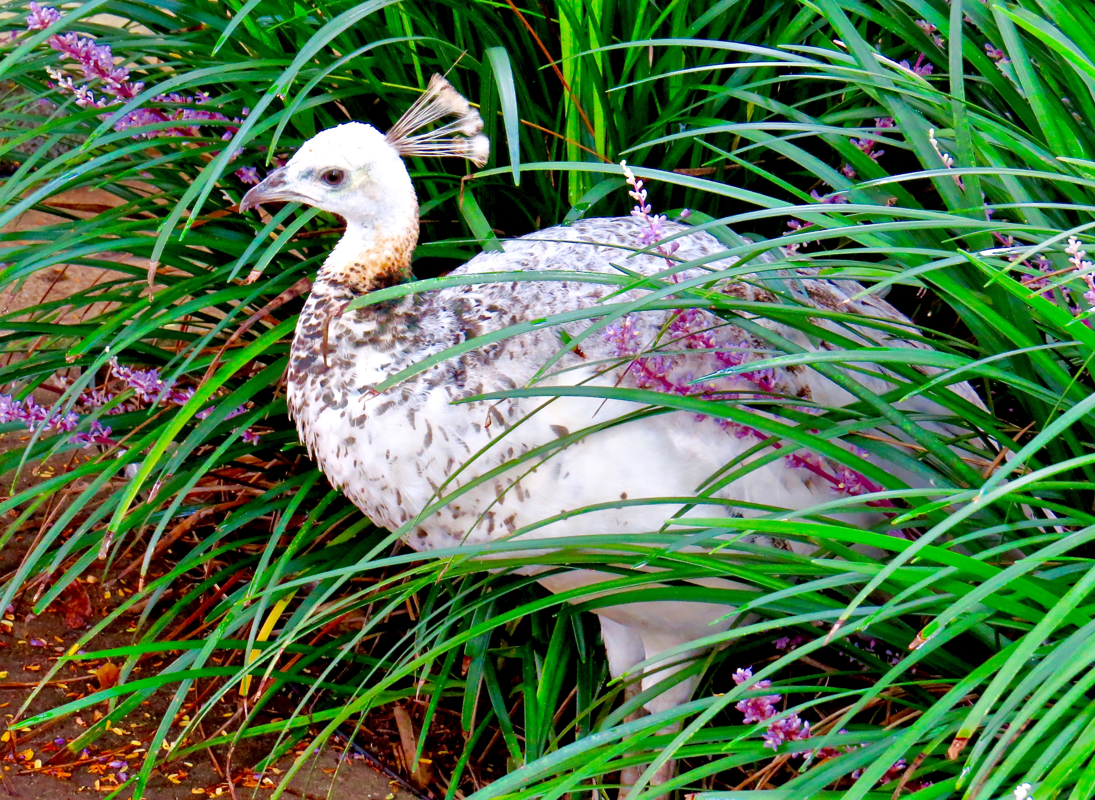
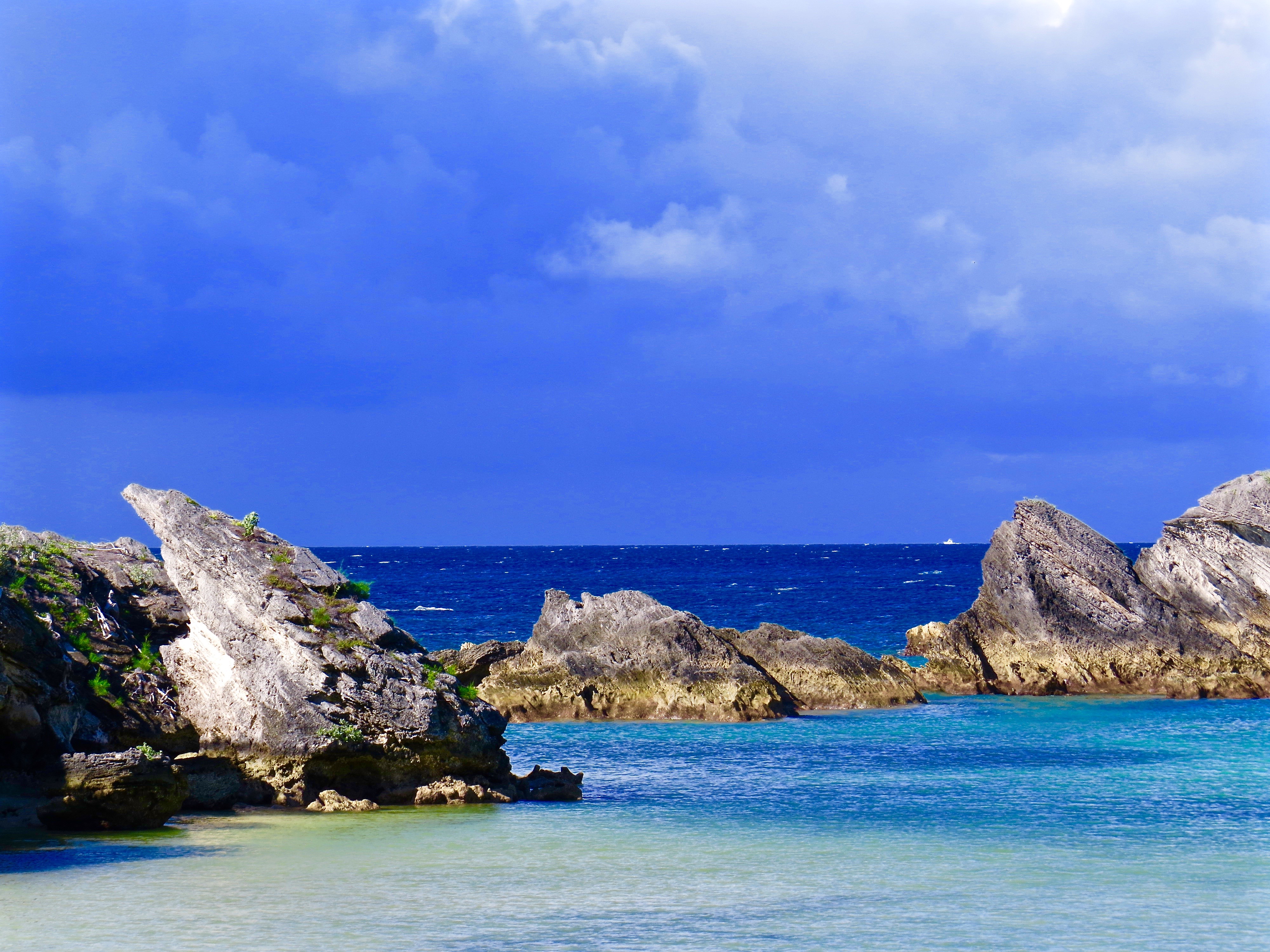
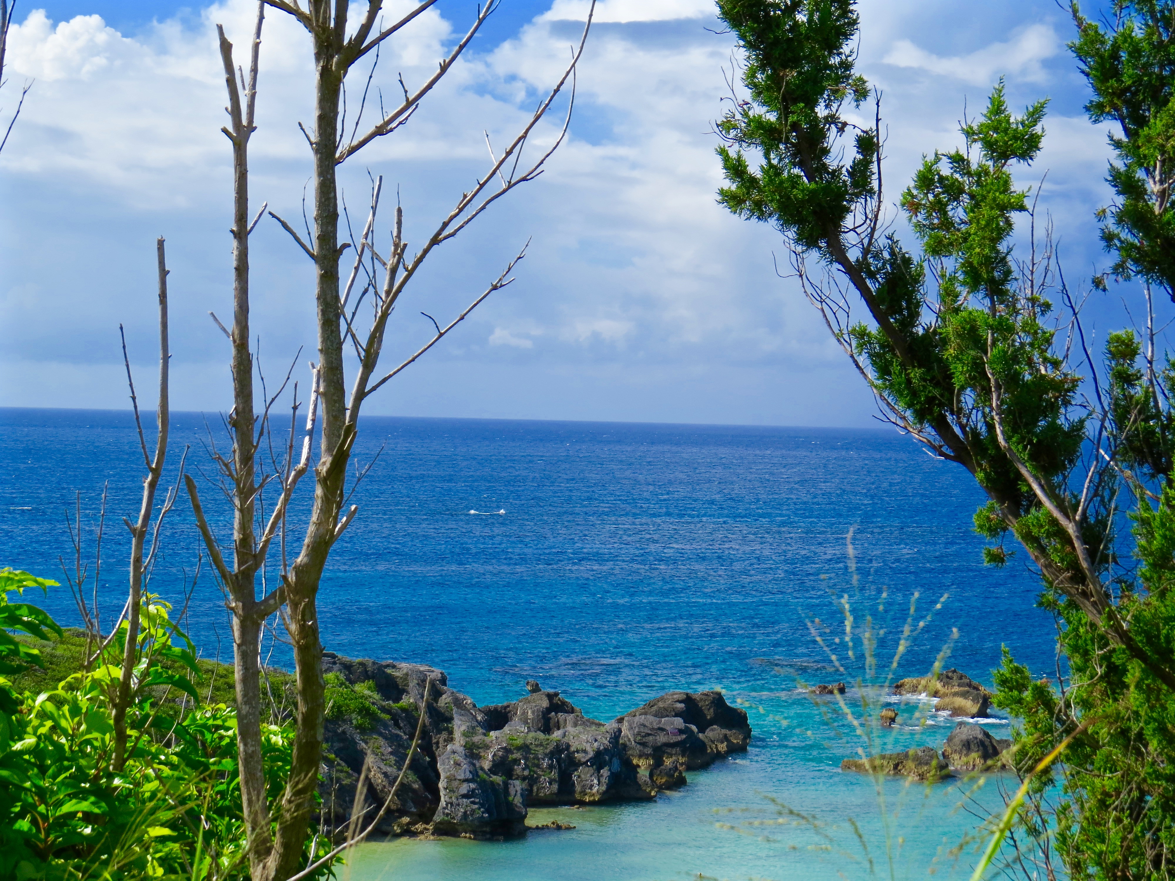
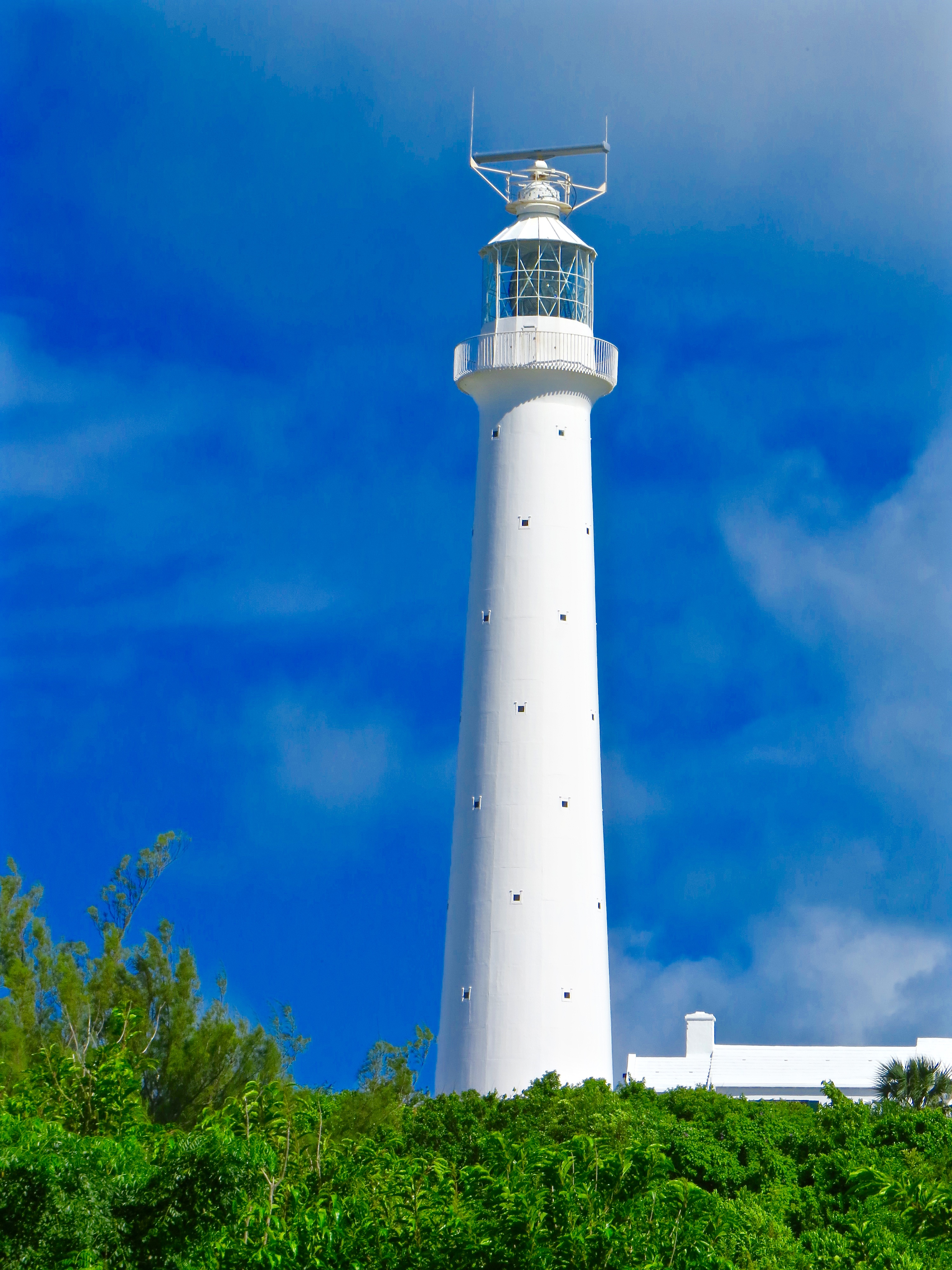
Bermuda: A Photo Essay
It’s a chilly 47 degrees here this morning in Elgin, IL. Hard to believe that a week ago I was enjoying the beautiful warm sunny weather in Bermuda. I thought I’d share some of the pictures I took on our trip. All photos were shot at the Fairmont Hamilton Princess & Beach Club, the private Princess Beach Club and the Bermuda Aquarium, Museum & Zoo.


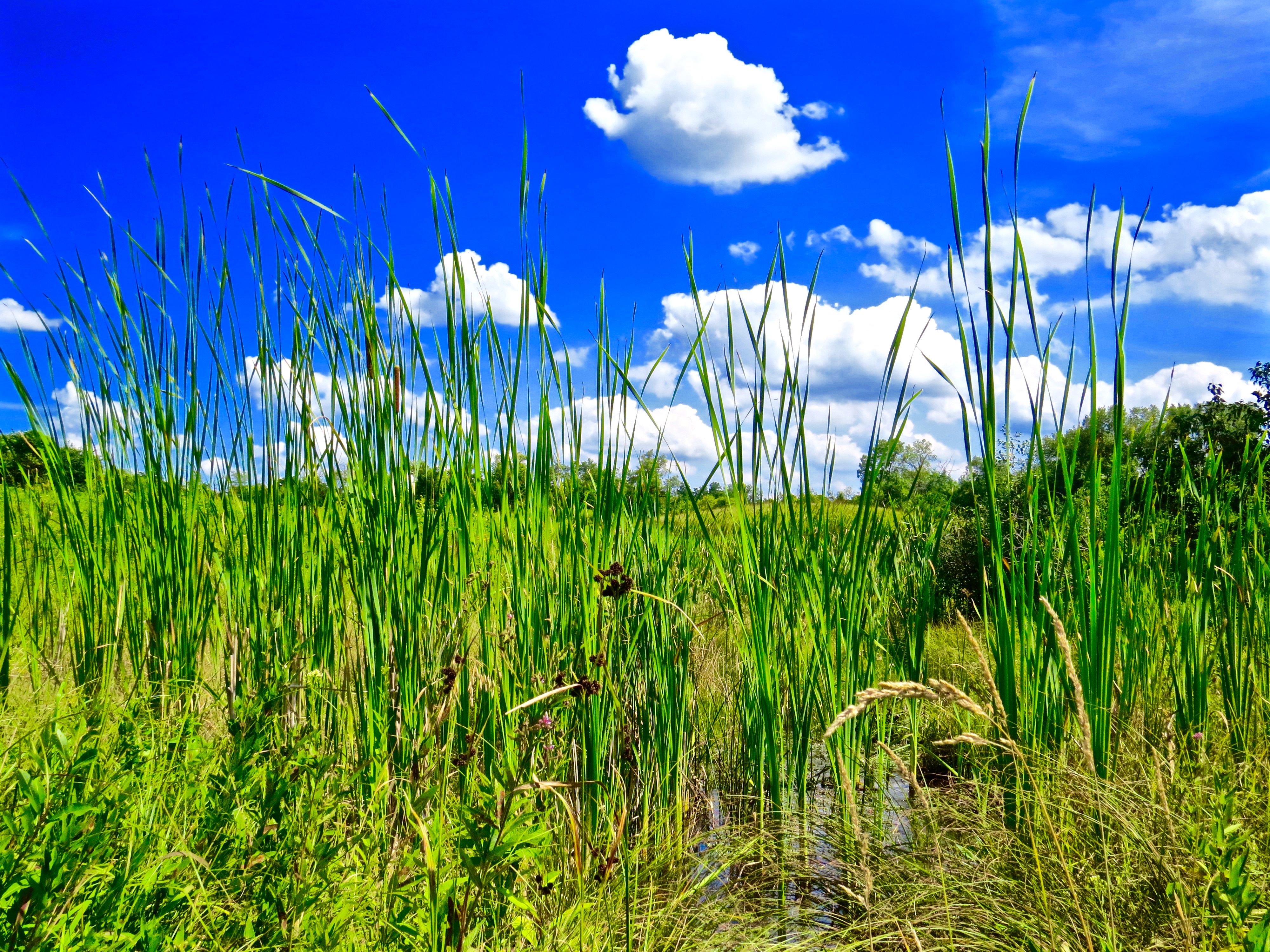
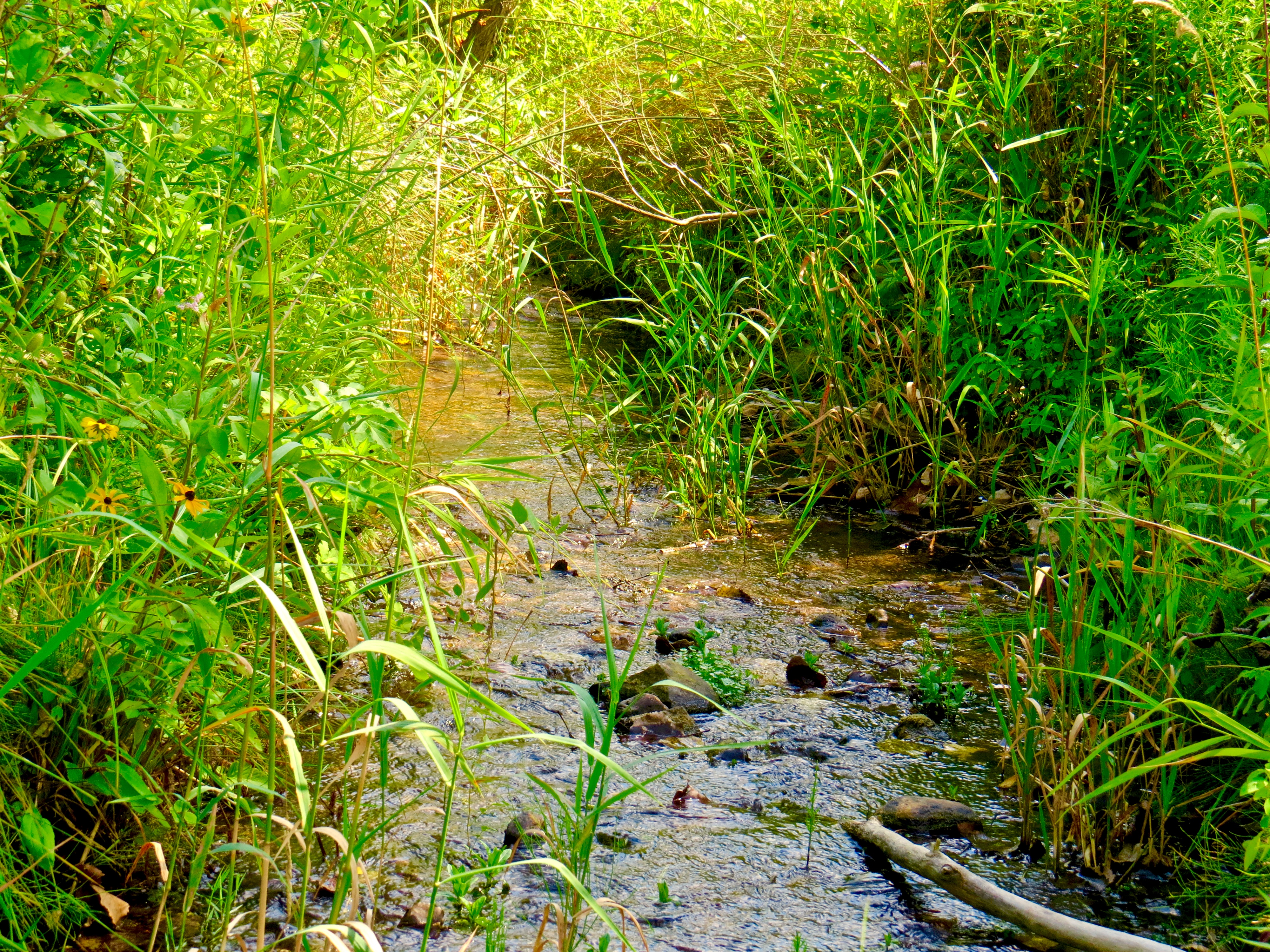
Afternoon At The Fen
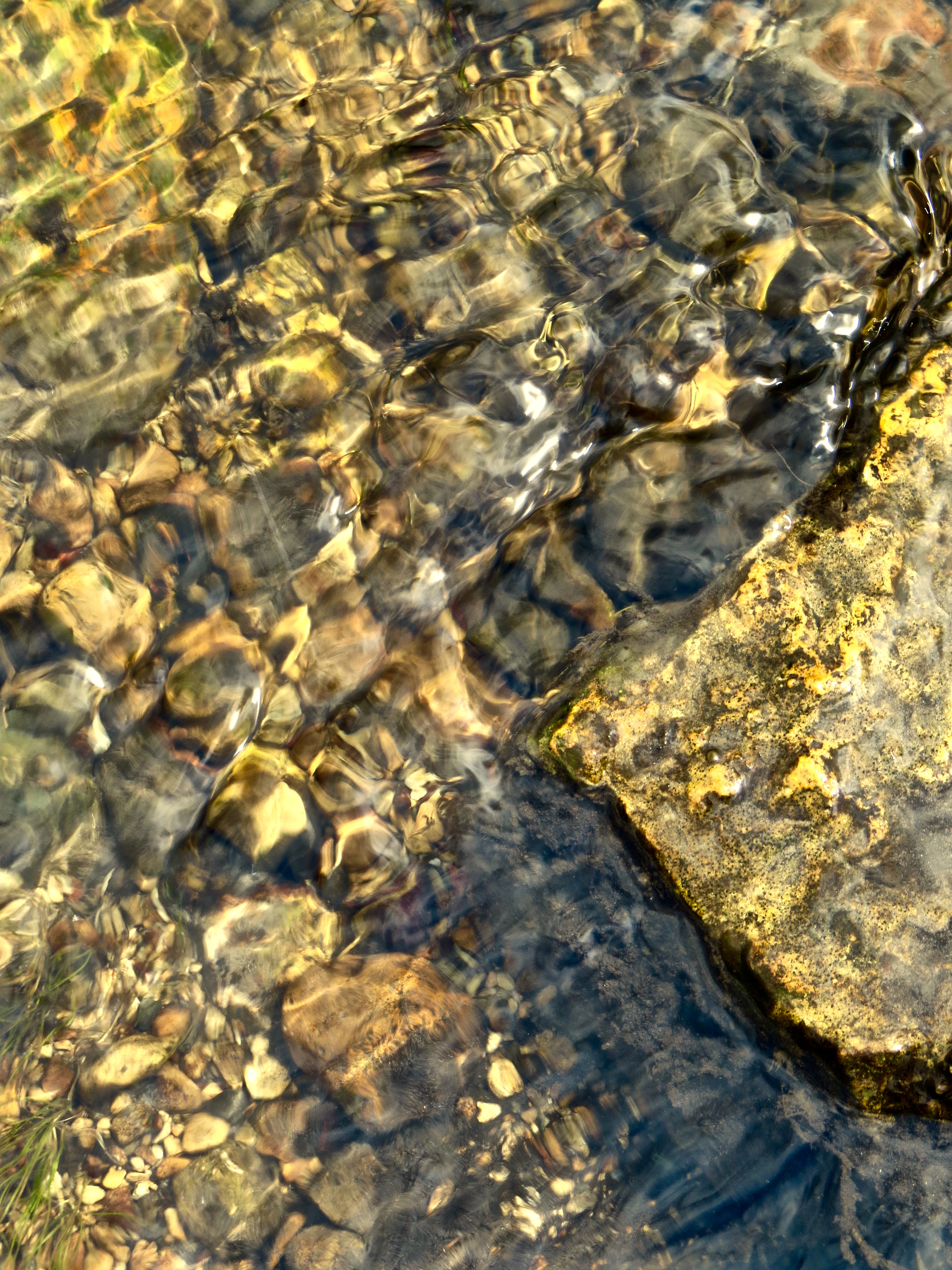
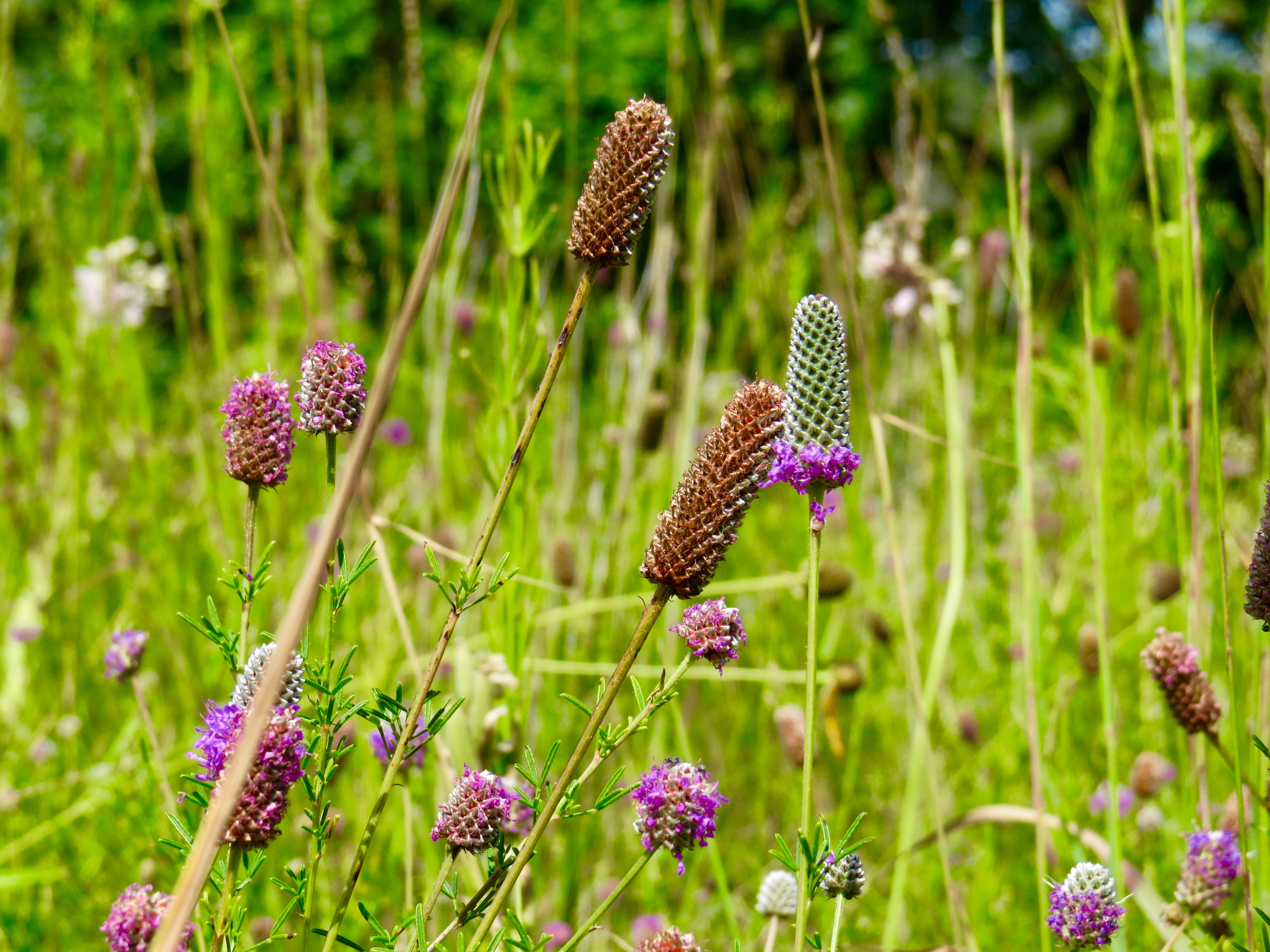
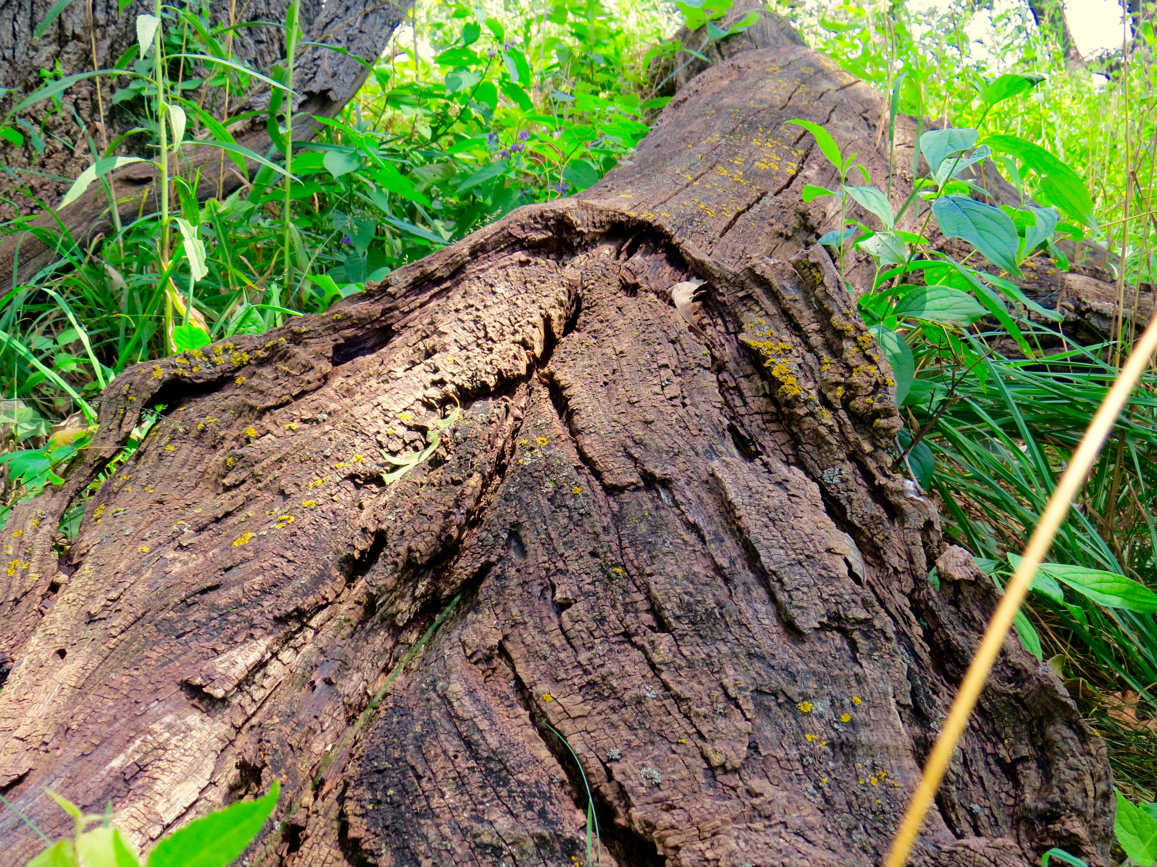
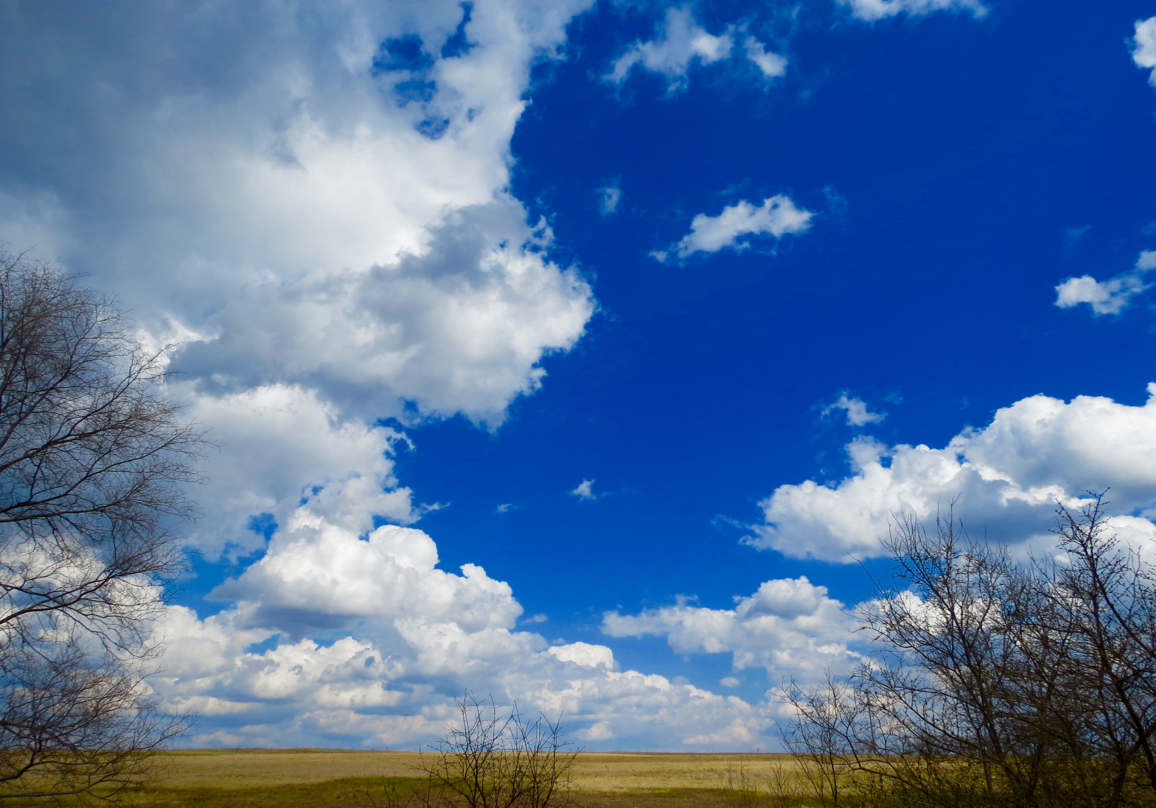
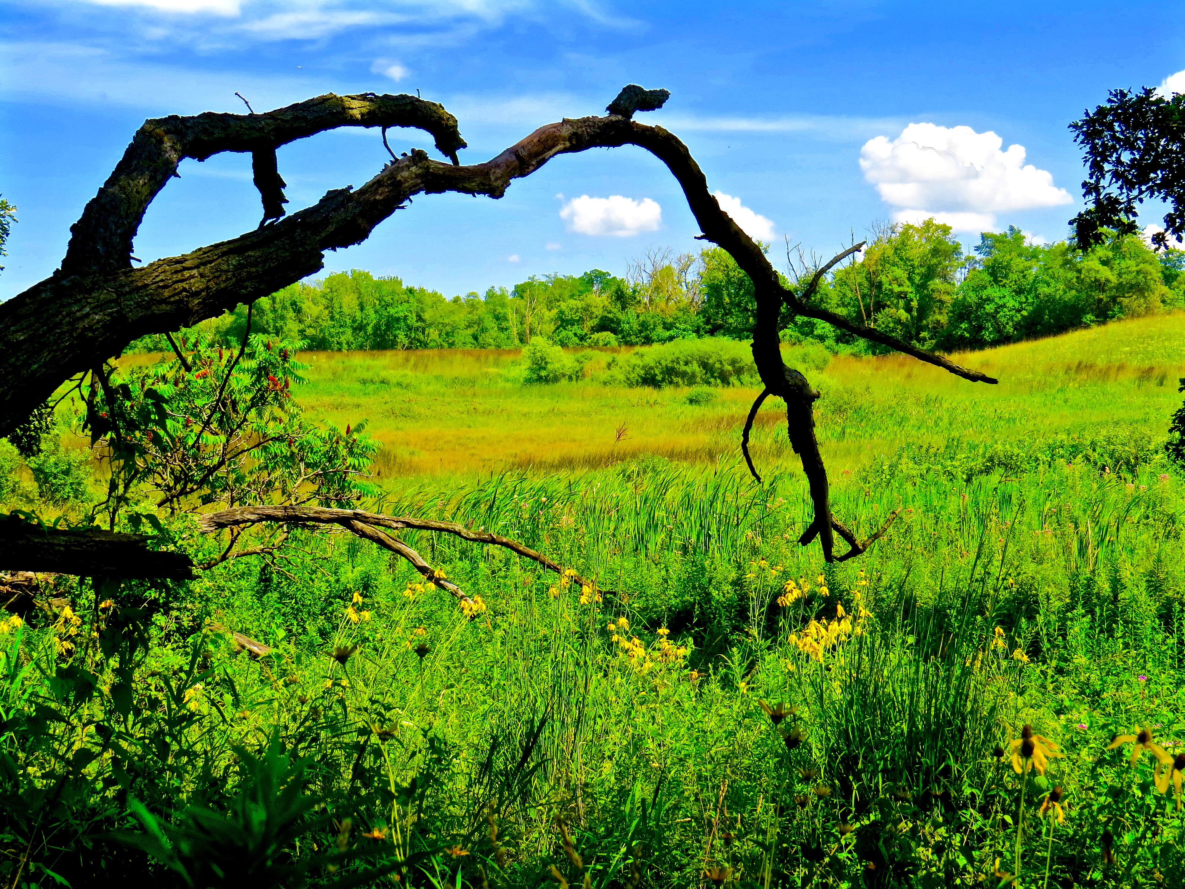 Thursday was sunny and hot. It was the perfect way to spend an afternoon, visiting the Bluff Spring Fen. I was treated to a nice breeze blowing through the fields and the sky provided a spectacular cloud show.
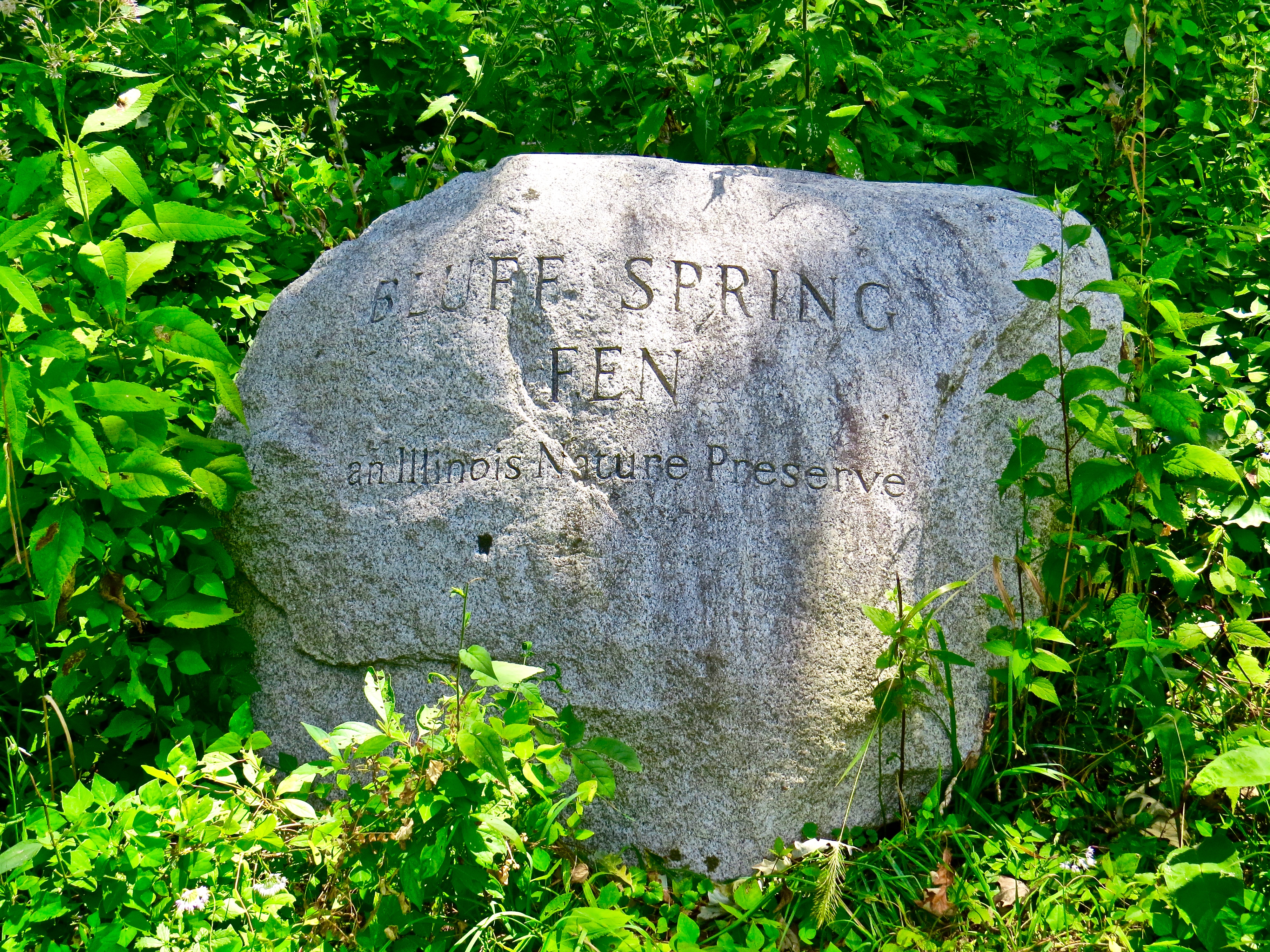 A fen is defined as a type of wetland. This 160 acre, mineral-rich, spring fed fen is part of a larger 225 acre nature preserve managed by the Forest Preserve Districts of Kane and Cook Counties and the City of Elgin.
Nature preserves have a higher degree of protections and regulations than parks and forest preserves. There are no picnic tables or shelters. It is not a playground. No cycling, dogs or horseback riding are allowed. With extremely narrow paths and an occasional footbridge, it is the perfect place for a tranquil walk and to view rare and protected plants and wildlife.
Here are a sampling of the photos I took on my first visit.


I look forward to visiting again and capturing the change of seasons in the months to come.

Exploring the Fox River Trail
Whether you live in a rural or urban setting, and whether you know it or not; there are some amazing walking and biking trails near you. I found sights, sounds and smells that can dazzle to extremes, just a short distance from my home. I can experience the city, farm and fields, beautiful river and forest views; all in a relatively short distance. The sounds of traffic, babbling brooks, chirping birds… even silence. Stale city smells, pungent livestock, fresh forest air… are all there waiting for you to explore.

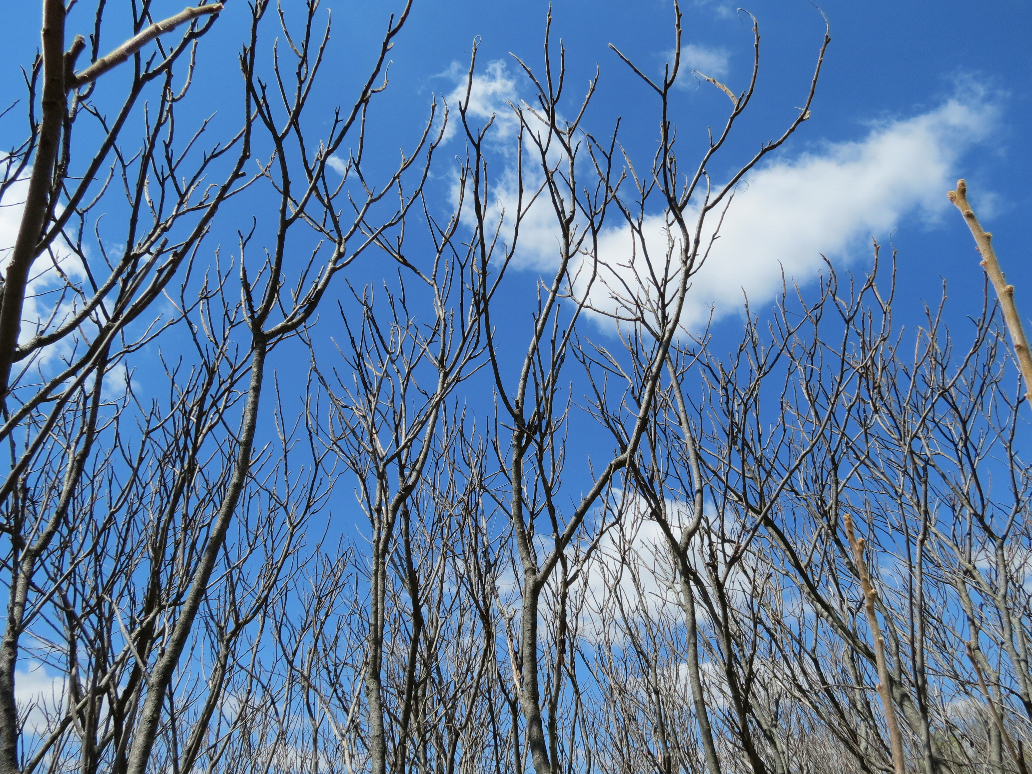
A little color as spring begins to invade Trout Park along the Fox Valley Trail.
Last week, I took my longest ride so far, traveling south from Elgin down to the heart of St. Charles. There and back, my ride clocked in at just over 22 miles, round trip. To date, I’ve covered about 16 miles of the Fox River Trail (FRT) between St. Charles and East Dundee.
In total, the trail is approximately 43 miles long from Montgomery to the south, to Algonquin on the north end. The trail links in multiple locations with other Illinois trails branching out in other directions.
Here are some highlights, as well as some tips to help you avoid getting lost and to work around some trail closures. I’m sharing some photos I’ve taken along the path over the past few weeks.

One of the best urban portions of the ride, travels through Elgin, along the Fox River, passing Walton Island Park.
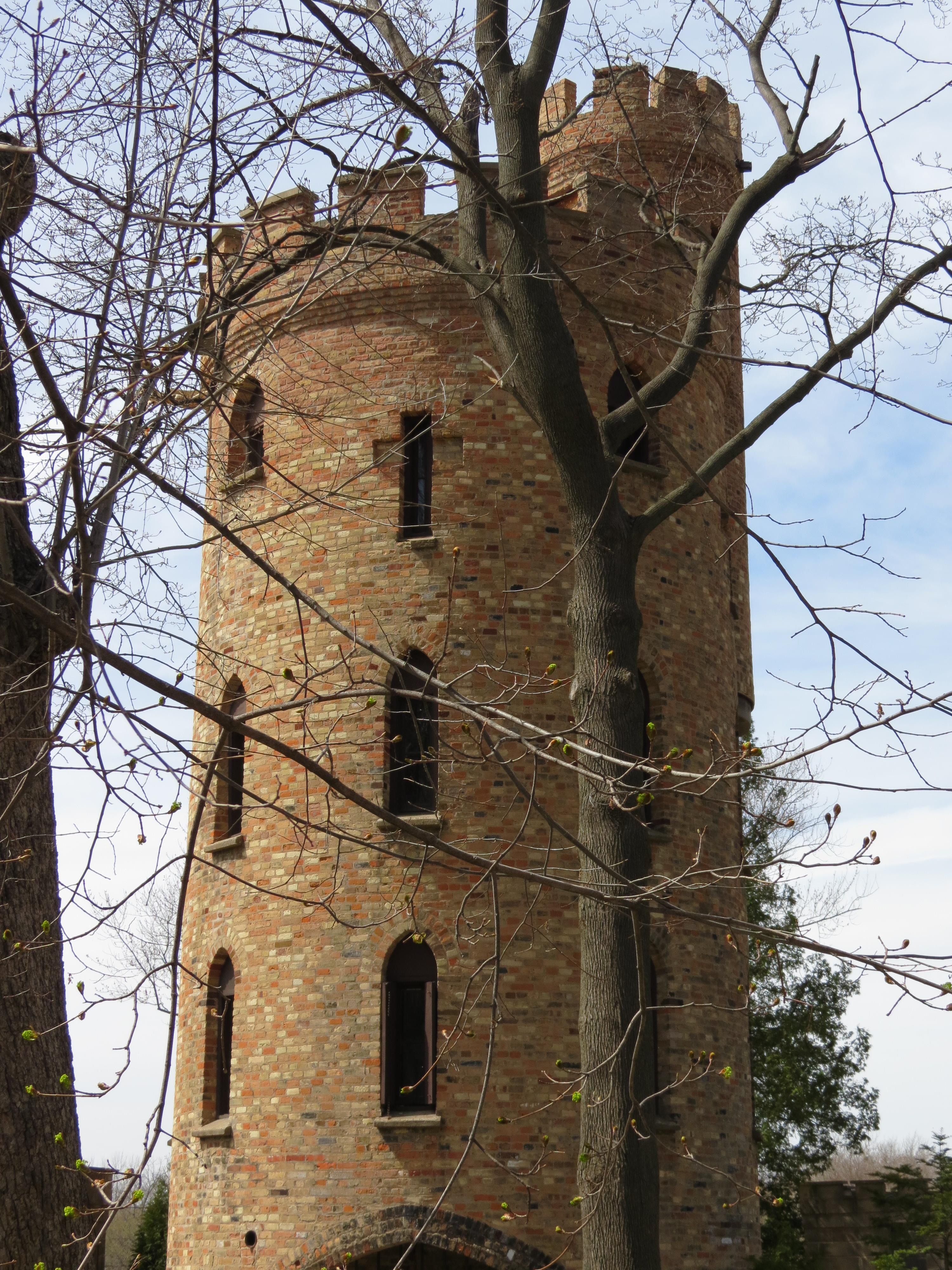
Pratt’s Castle, north of downtown Elgin (1262 Cedar Ave, Elgin, IL) along the Fox River Trail.

“Brick Roadway on North Spring Street” (1930’s) is the last exposed brick remaining in Elgin.
Detours. I was naive enough to believe once you were on the trail, you’d stay on a clearly marked trail. It’s not the case. There are some closures and detours you’ll want to be aware of along the trail.
Traveling north from Elgin on the Fox River Trail. There are really only two minor considerations you’ll want to know about traveling north of downtown Elgin. The first, is a pretty simple jog that takes you a few blocks east of the river, around the Gail Borden Library, to allow you to cross near the Kimball street bridge. There are green bike signs that help get you across this busy street. You then have the option of taking the sidewalk around either side of the library until it reconnects with the trail. This is a permanent part of the path. I should note that once you cross Kimball, you should take the side walk south of the library back down to the river or you’ll miss a beautifully maintained section and the Veteran’s Memorial. Otherwise, you just continue straight ahead, passed the library and a large (currently) vacant piece of land, back to the actual trail going north.
The second spot is at I-90 about a quarter mile passed Trout Park. The path is not closed there. I saw one post online stating it was closed. You are crossing through a construction zone– and there are signs requesting you walk your bike through the short stretch, although most cyclists I’ve encountered, ignore the signs. The bridge that crosses the river at I-90 (taking you off trail) is closed and under construction.
Traveling south from Elgin on the Fox River Trail. A couple miles south of Elgin the FRT is closed. If you’re not paying attention, you’ll suddenly find yourself traveling along the Illinois Prairie path, and not know how you got there, or how to get back on the FRT. Forking off to the west is a closed path that appears to dead end at a train trestle. There is actually supposed to be a bridge

The FRT detours here. The bridge is gone that is supposed to go under the left arch connecting the trail.
going under the trestle that connects the trail. This spot tripped me up my first ride. It is not marked as part of the FRT and there are no signs anywhere that instruct how you can detour back to the trail.
The best work-around I found, is to take the Illinois Prairie Path to Middle Street and go west, into South Elgin, go north one block on South Gilbert Street to State Street and then taking the State Street Bridge west, putting you are back on the trail again.
On my return trip, I did investigate the ‘skipped’ portion of the FRT and it is walkable but not easy to ride– up to where the bridge is out. That portion of the path is in extreme disrepair, lots of steep and bumpy, twisting spots that need to be redeveloped– if and when the bridge is replaced.
Seba Park on the west side of the Fox River is currently under construction but you can follow the path through, staying on the trail. From there, the trail is quite beautiful and unobstructed. Following the shoreline of the Fox River, along side a railroad track for some distance, is a nice peaceful ride.
There is one long, fairly steep incline that I find too difficult to ride and walked it instead, when heading south. It’s fun riding north though— but you need to use your breaks.
As you get close to St. Charles, there are a few spots where you have to ride main roads and residential streets between gaps in actual dedicated paths— so you’ll need to use extreme caution if walking or cycling. Some spots aren’t marked, you just continue straight ahead and the trail will become clear when it picks up again. I used the TrailLink app and GPS just to be sure.
Farms, fields and sky along the Fox River Trail and Illinois Prairie Path.
Where Bridges and Train Trestles Meet. One of the spots where the Fox River Trail and Illinois Prairie Path link.

Biking across the Fox River, north of St. Charles on the Fox River Trail.

Stunning view of the Fox River.

Much of the Fox River Trail follows along functioning and unused train track.
Open blue skies.
I stopped when I reached downtown St. Charles because I was confused where to go. The map shows the trail forking and following both sides of the river through downtown. You cannot ride your bike on the sidewalks in downtown St. Charles though. The narrow roads and traffic congestion make riding in the streets a little daunting as well. Signs are posted requiring cyclists to walk bikes on sidewalks. Since I was out for a ride, not a walk; I decided to turn back towards Elgin at this point. I found out later, there is an actual riding path on the west side of the Fox River, which after some distance, must cross back over the river to the east side, before heading south towards Aurora.
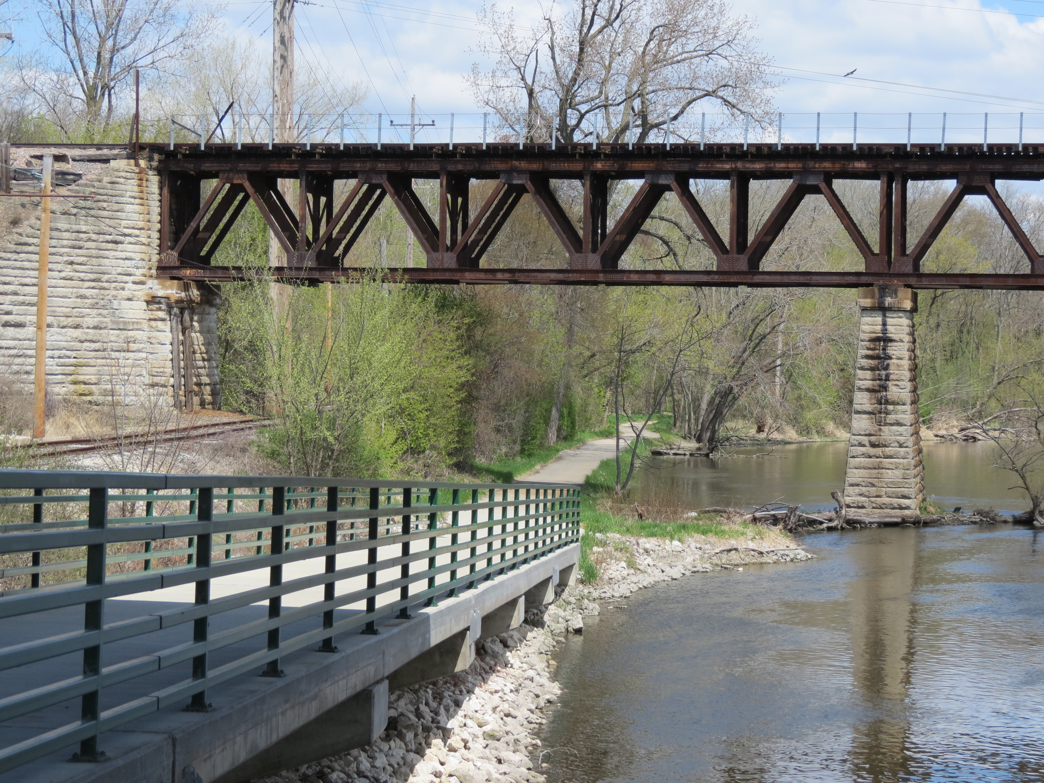
On my way back, a work crew on the path forced me on a bit of a detour through a small portion of Tekakwitha Woods. I was rewarded with a stunning bridge view I would have otherwise missed.

Just off the FRT in the Tekakwitha Woods.
I’m looking forward to more exploring this summer. My next goal is to ride from Elgin to the northern trailhead in Algonquin. A friend of mine just told me yesterday that north of East Dundee, is a beautiful scenic ride.
There are thousands of miles of trails across the United States and some are bound to be near you. Some you never knew existed. Get out there and explore!
Suggested Links:
- Trail Link- Fox River Trail
- Kane County Forest Preserve- Fox River Trail
- Fox River Bike Trail
- City of Elgin- Biking & Walking
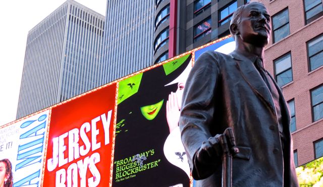
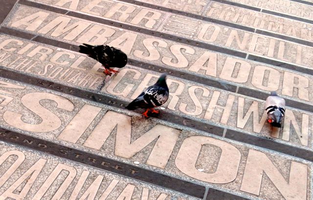
Photo Essay: Times Square Six AM
These photos were shot in and around Times Square in New York City at 6 AM, Sunday May 25, 2014.


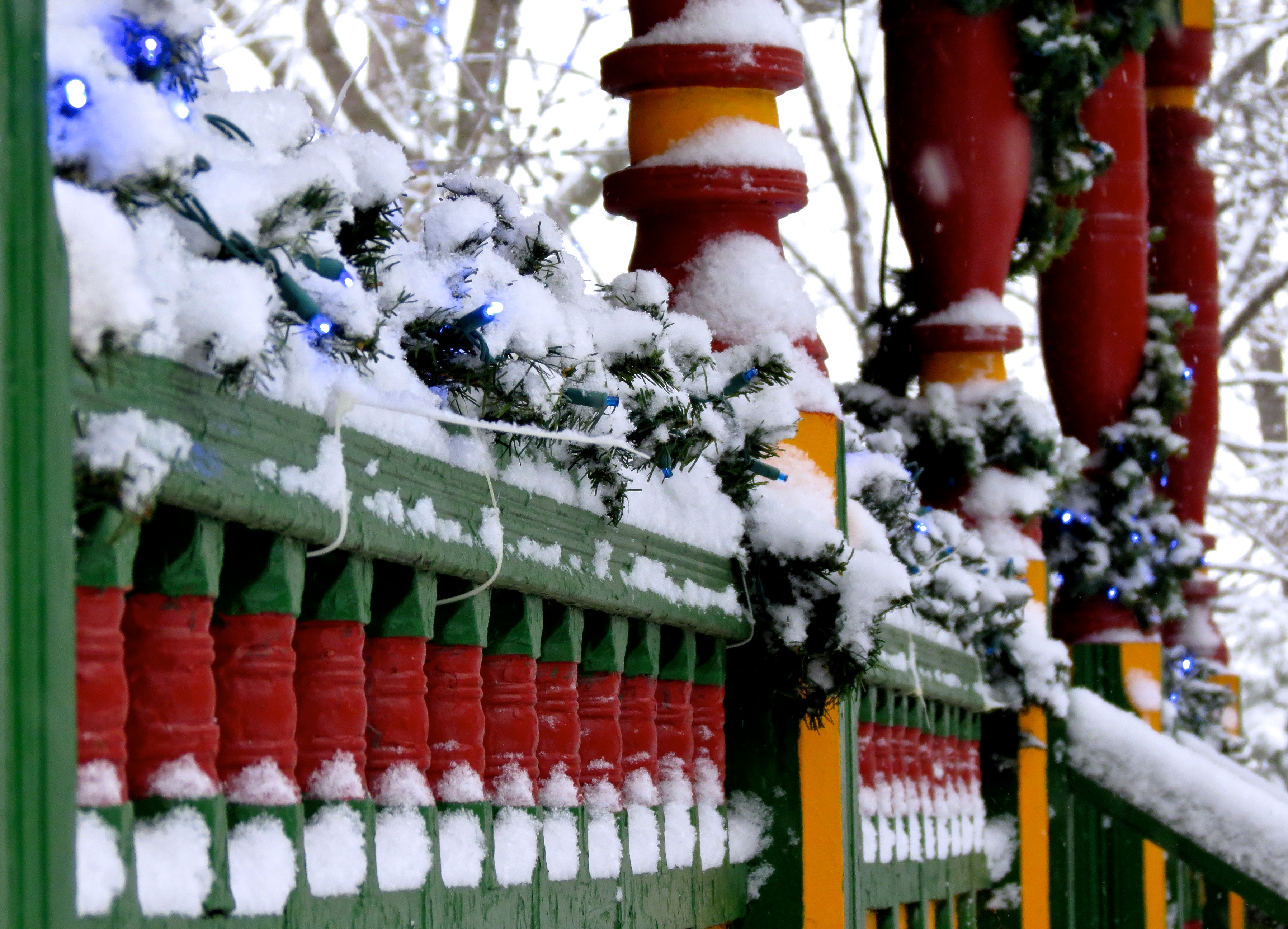
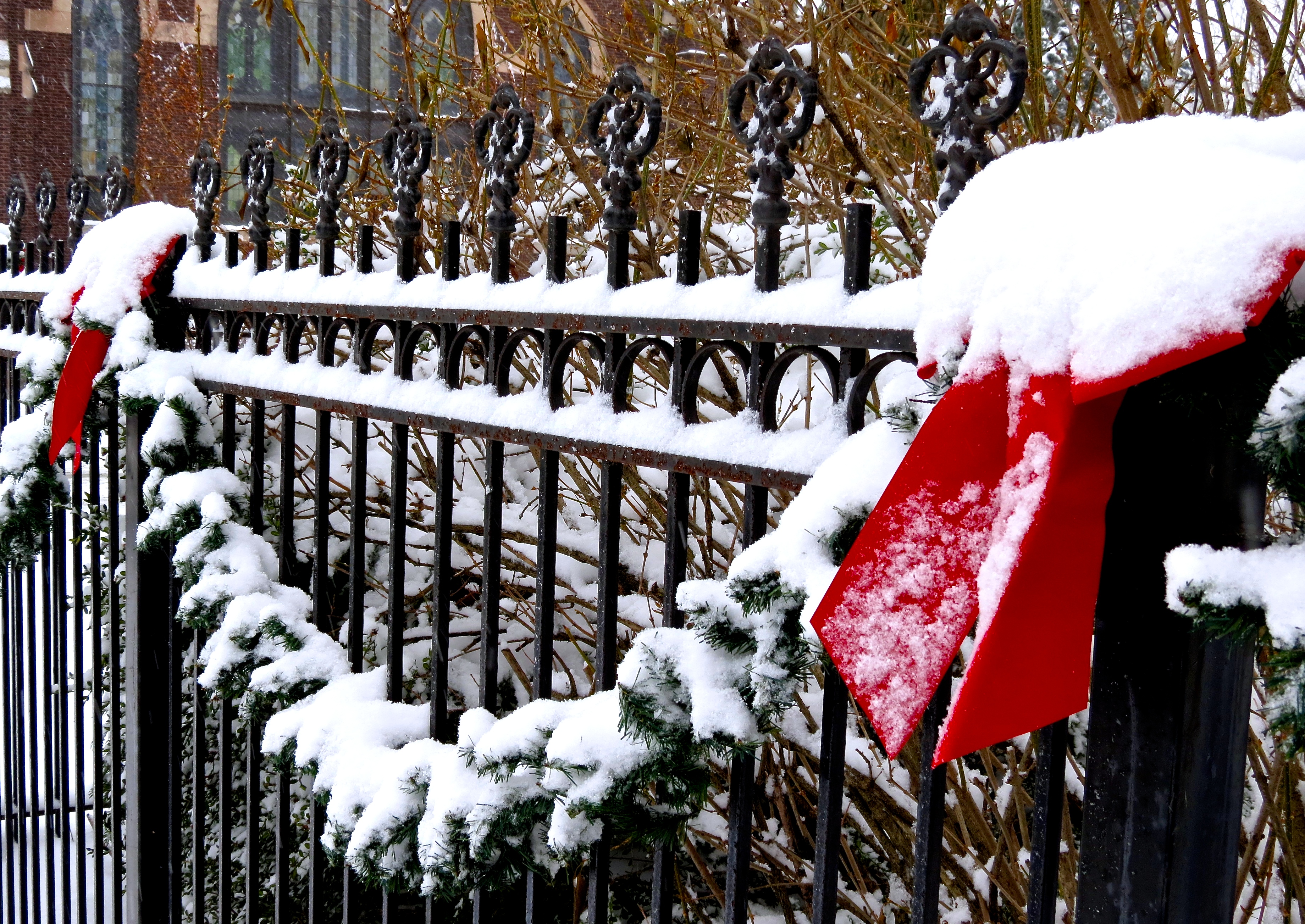
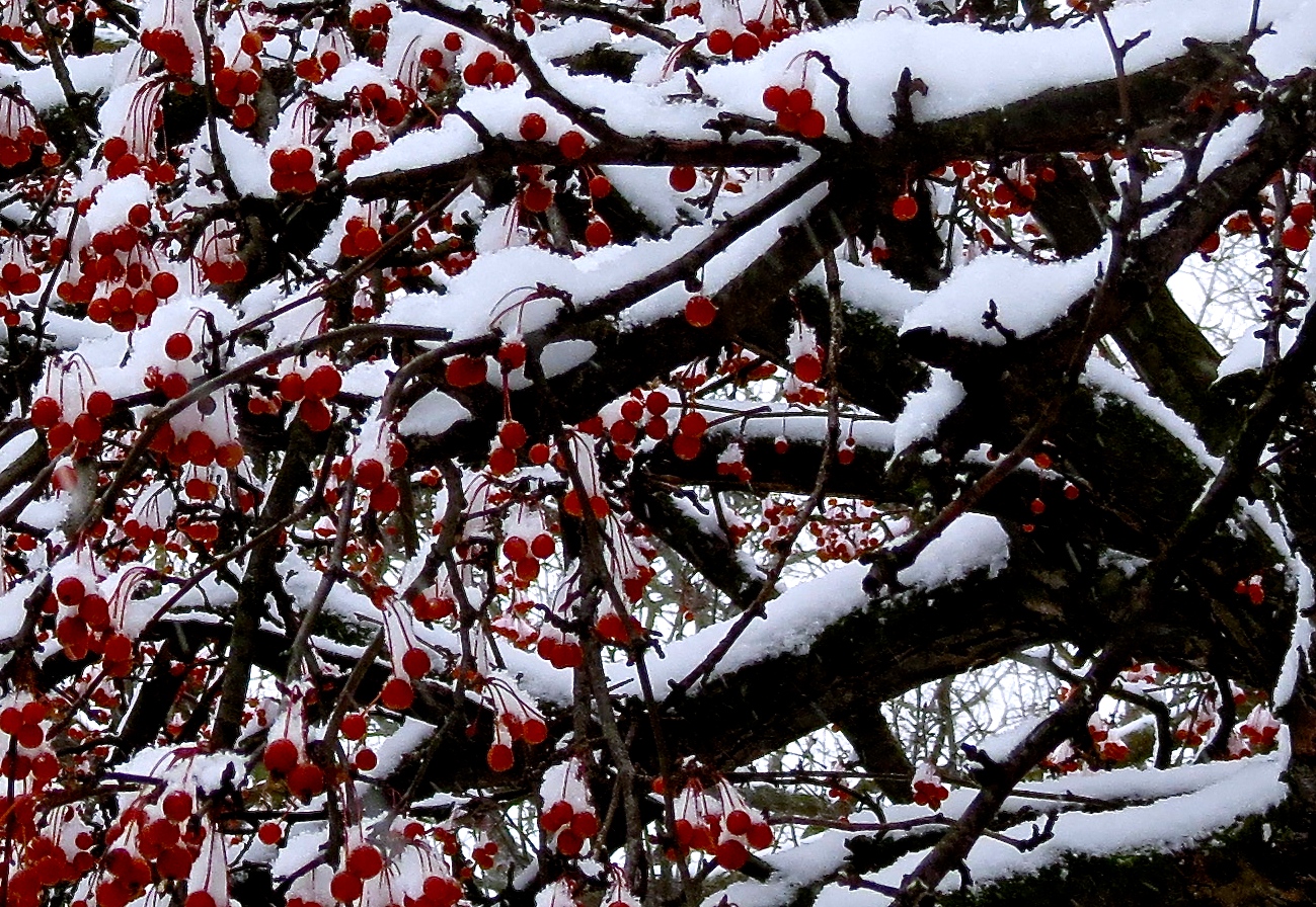
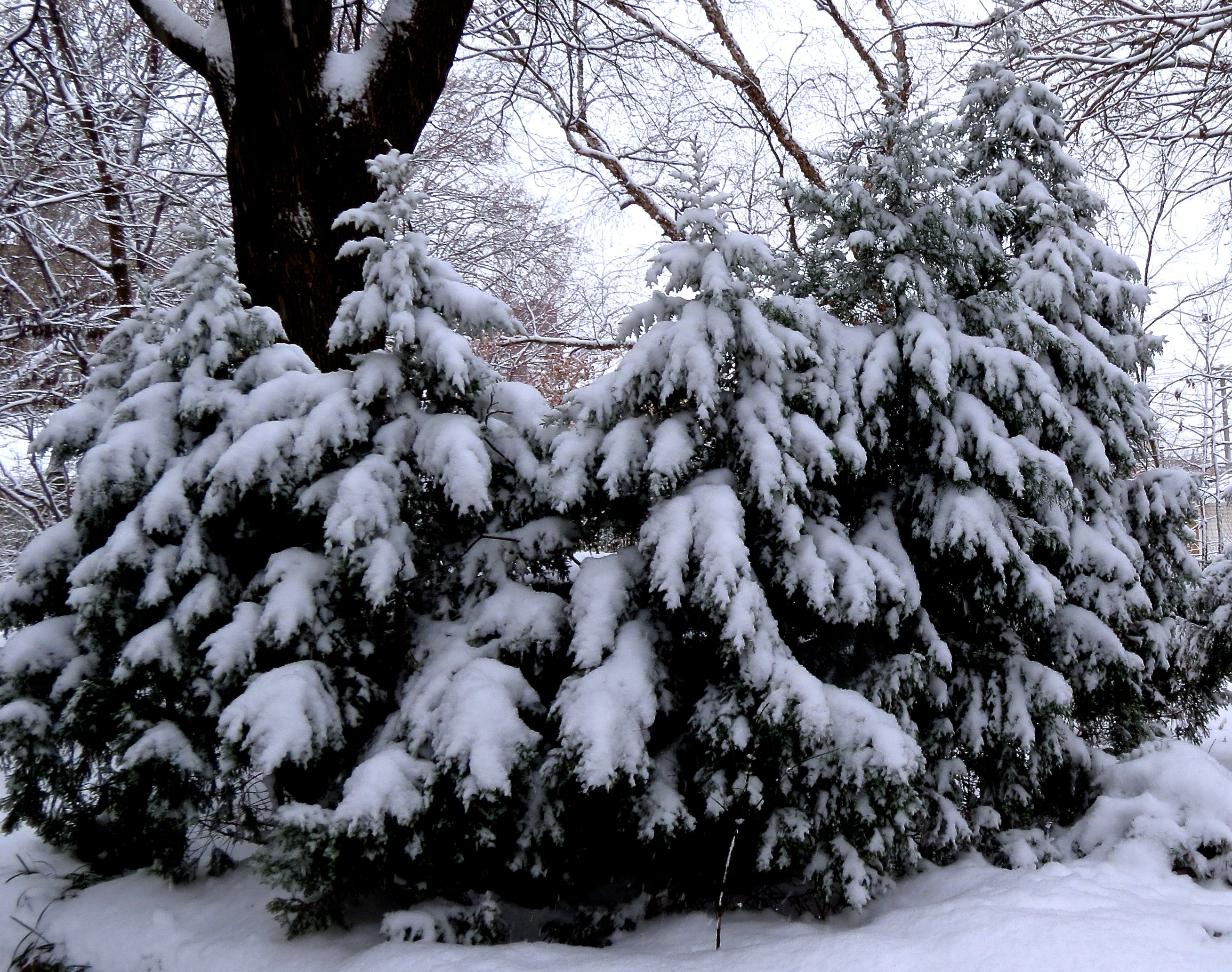
Winter Dreams: A Photo Essay
We had a beautiful snow yesterday– so at my Dad’s request, I took the opportunity to shoot some photographs around the house. I hope you enjoy them! (If you click on the photo, you’ll be taken to a larger image.)